Lets Create a Healthy Hanford, CA. Hanford Health & Demographics
Where is Hanford, CA you ask? On average, more than 90,500 monthly online searches ask the question: “Where is Hanford?” I don’t know if that suprises you or not. Maybe it doesn’t given that you knew there was a Hanford, CA and a Hanford, WA. But, how would you tell them where Hanford, CA is? Would you say…
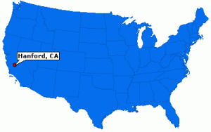
Hanford-CA
Hanford, CA Geographically
Hanford, CA is the wonderful city located in the San Joaquin Valley, in Kings County, 1 hour and 24 minutes north of Bakersfield, 42 minutes south from Fresno, 2 hours 18 minutes East of Pismo Beach, and 20 minutes West of Visalia, CA.
- Hanford, CA Map Link – Google Maps
- The latitude of Hanford is 36.327N. The longitude is -119.644W.
- It is in the Pacific Standard time zone. Elevation is 249 feet.
- The estimated population, in 2003, was 45,368.
Is Hanford a Healthy City?
What if you were asked an important question about Hanford like, “Is Hanford a healthy community?” Would you be surprised, or could you tell them? To tell someone where something is you often reference other locations as well as specific data and facts unique to the described location.
“To find out where we are regarding our Health as a community, we should consider the relevant data and where we are in relation to other communities.”
Continue reading Lets Create a Healthy Hanford, CA. Hanford Health & Demographics


